River Trent and River Ouse via Trent Falls
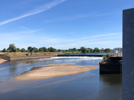
Sandbank below the weir and lock at Cromwell |
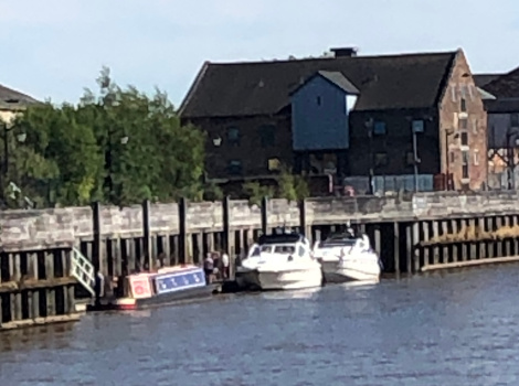
On the floating pontoon at Gainsborough |
|
We were approaching the end of familiar waters, we
had negotiated the tidal Trent from Cromwell to
Torksey on our way to the Wash but were now heading
down to the mouth of the Trent where it joins the
Ouse and becomes the Humber Estuary. It was
approaching low water springs when we arrived at
Cromwell and a walk down the towpath showed the
large sandbank between the weir and lock exit. The next morning we locked down onto the tidal
river and headed north past the entrance to the
Fossdyke and Witham at Torksey and down to
Gainsborough, formally a large inland port but now
left in decline as larger ships cannot navigate that
far up the Trent and now discharge their cargoes at
Hull, Goole or Immingham. A reasonable mooring for
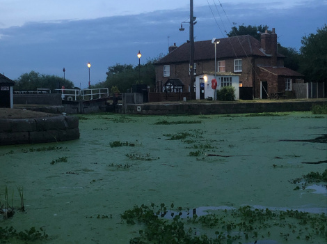
the night on the floating pontoon in the tideway. The Monday morning broke clear and with a gentle S breeze, perfect for boating. An uneventful run down to the anchorage before Trent Falls, as the junction of the Trent and Ouse is called. Joined two other boats and had lunch while the end of the ebb flowed past us. The tide turned on schedule and we pushed down the last of the Trent, around Trent Beacon and turned onto the Ouse, past the entrance to Goole and up an increasingly fast flowing flood tide, round sharp bends with eddies and whirlpools. A challenging entrance to Selby Lock [on a par with Limehouse] finally saw us end an eleven hour day in a duck weed filled canal basin. |
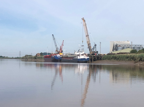
Coasters unloading at Gunness opposite Keadby |
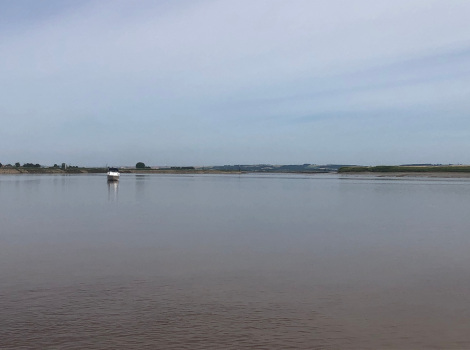
View down river from the anchorage with Trent Falls ahead |
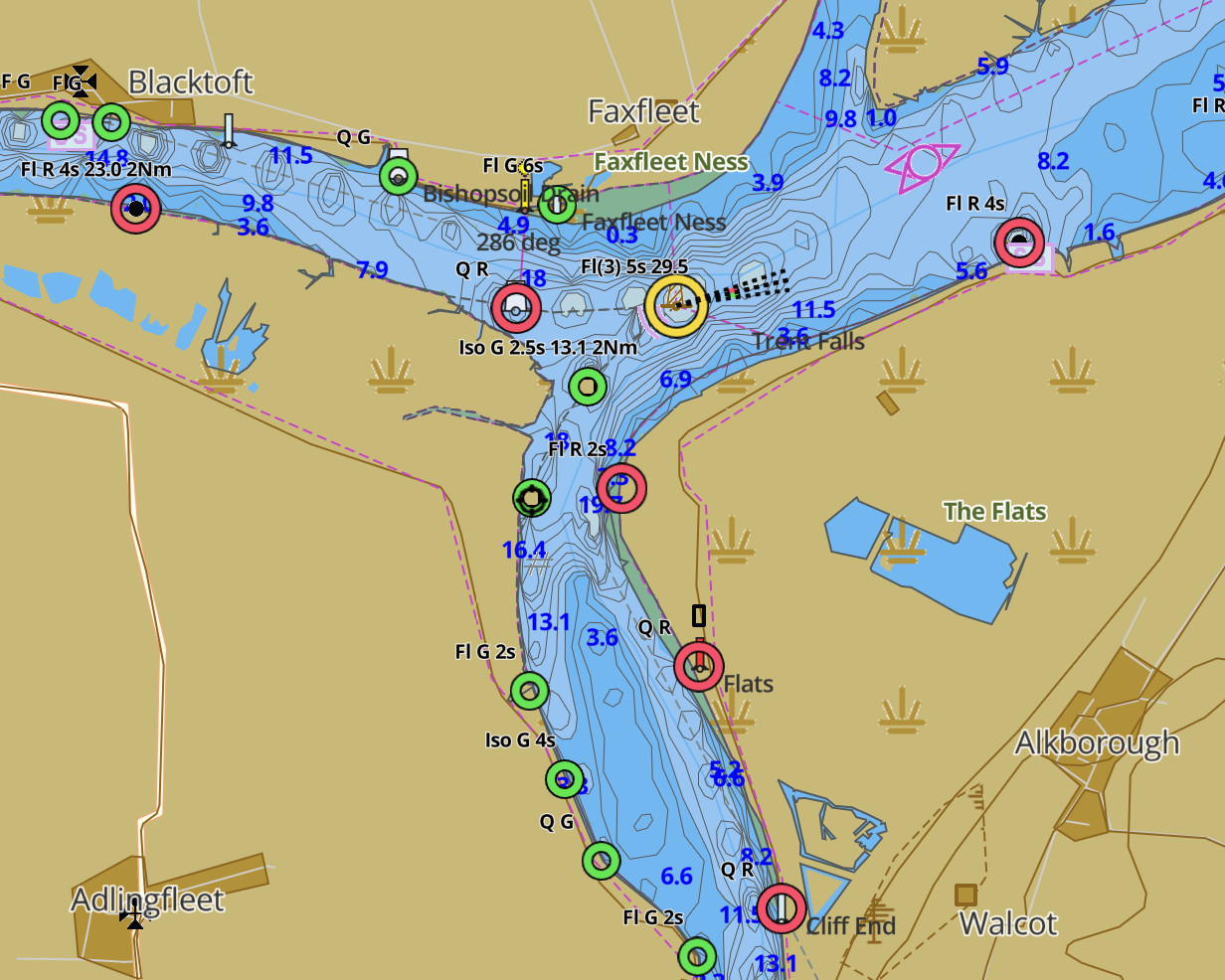
Chart showing Trent at
bottom, Ouse to left and Humber to right |
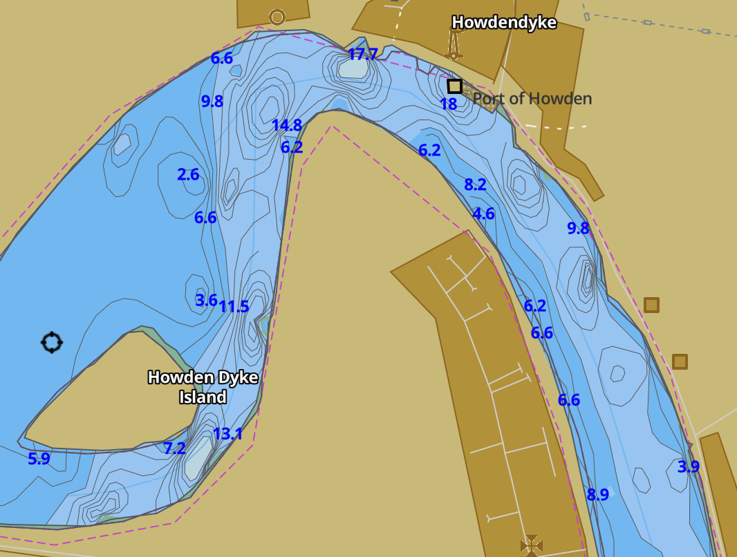
Chart of the R Ouse at Howden showing the sharp bends and deep pools |
Selby canal basin in the evening |